The Scary Highpoint
[Summit team: Targo]
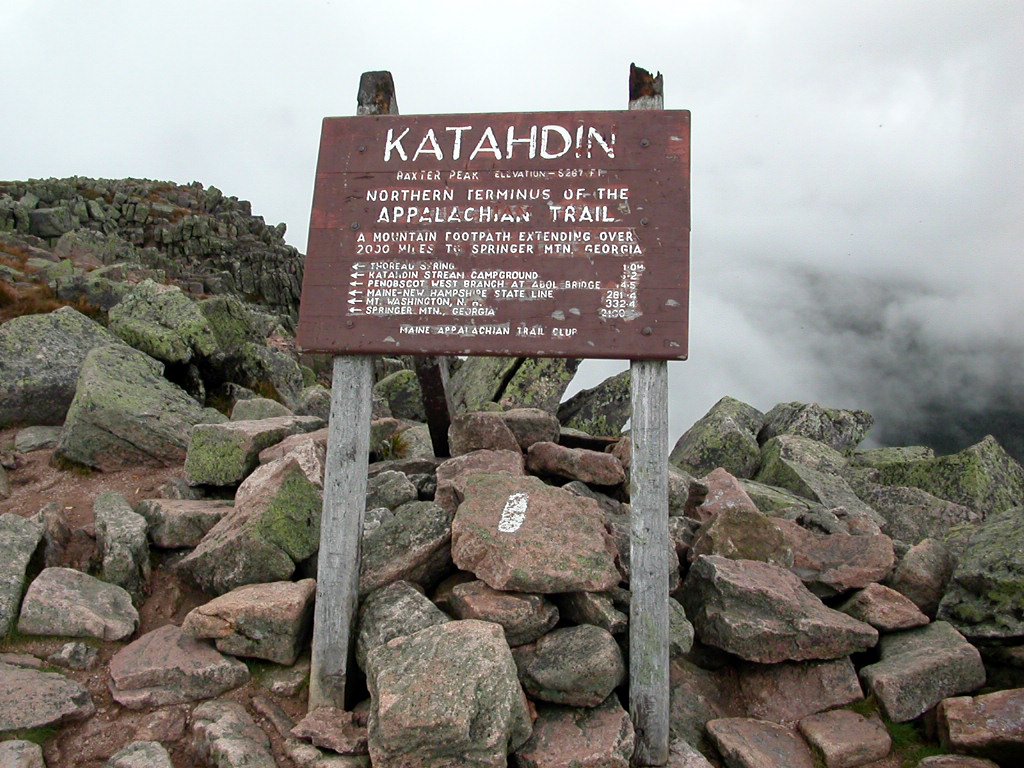
Katahdin (you're not supposed to say Mount Katahdin as Katahdin already means
"Great Mountain" in a local Indian language) was my toughest highpoint to date.
Despite its modest absolute height, it featured biggest elevation gain,
hand-over-hand rock scrambling, and some quite rotten weather.
The closest noteworthy town to the mountain is Millinocket. Almost everything in
town is named after either Katahdin or Appalachian Trail (Katahdin is the
northern terminus of the trail); this is where the AT hikers are picked up after
they finish their journeys and where most non-campers that attempt Katahdin stay
overnight. We were non-campers and stayed in Katahdin Inn for $49, which was a
pretty good deal. The remnants of hurricane Frances had reached Maine, and it
had been raining for a while when we arrived in the evening of September 8th.
However, rain was pretty light next morning, and we set out to Baxter State
Park. The park opens at 6am weekdays, 5am weekends and can fill up quickly on
nice days, after which no vehicles can enter. Thursday, September 9th was not a
nice day, so we didn't get there until after 7:30am. There was a girl by the
entrance that warned me that weather was bad and it wasn't advisable to go above
the treeline. I insisted on at least scouting the mountain, so she advised
approaching the mountain from west, and hiking to Chimney Pond campground (my
plan was east to Katahdin Stream campground and then taking Hunt Trail/AT), to
see what the conditions were like by then, and then taking the Cathedral Trail
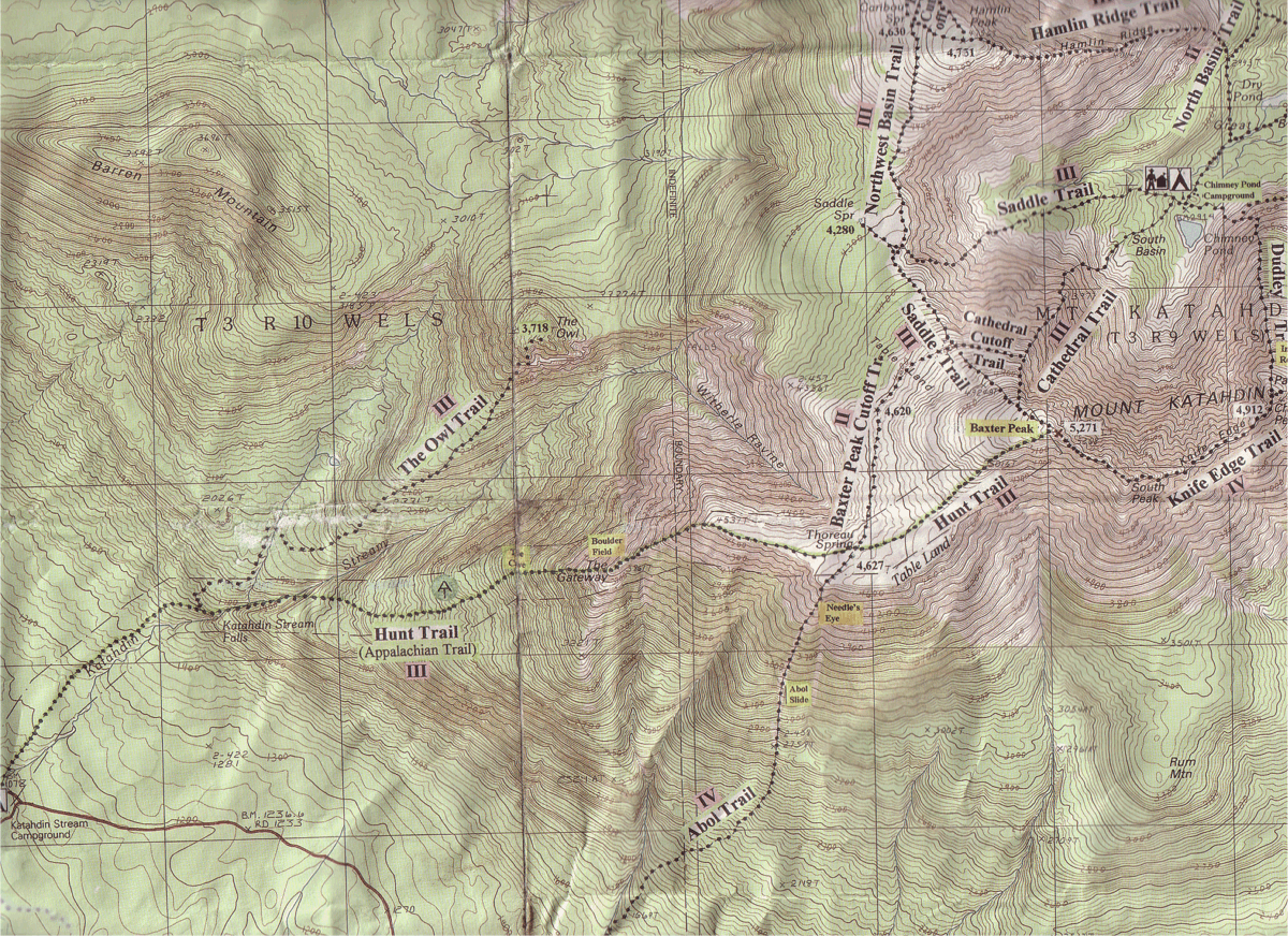
to the summit (here and later, click on the map below to find the places I'm
referring to). I asked if Cathedral was comparable to Hunt. No, it is much
steeper, she admitted. Um, that was some really weird advice then, take a harder
trail in marginal weather.
For the first 3 miles, the trail was hikable quite normally, occasionally
requiring the use of hands to get over some bigger boulders. But then, right
after the treeline, I reached a pile of huge (10-20ft) boulders. In fact, there
were permanent iron hooks installed in some places to provide additional hand-
and footholds, this should give you an idea of what it was like. Also, I
discovered three rather unpleasant facts: first, the wind was picking up,
second, I hadn't quite recovered from a cold I had caught earlier, and third, I
found that I was afraid of heights - not a very good trait for a highpointer
:-). Glancing down while hanging from a rock and discovering that there was
nothing below me but fog really dizzied me for a moment; I closed my eyes for a
minute and forgave all my enemies. After scraping together all my inner
strength, I tried to only look up and continued my climb. However, I didn't get
much further before I met some people coming down who said it was really windy up
on the spur and they didn't think it wise to continue. I didn't feel like being the
only guy on the mountain, so I came down as well. Total roundtrip time about 3.5
hours.
Later that day I met some people who were hiking the AT and had also decided
that this wasn't a good day for summiting, I gave them a ride to Millinocket and
we had some good time. I also heard a rumor that some guys had actually made it
to the summit but they had to crawl there because walking was too hard because
of wind.
I spent the rest of the evening following weather forecasts and heard that it
was supposed to get better by Friday afternoon, and pretty calm/dry by Friday
evening. Encouraged by this, we went to the park again the next day. The same
girl by the gate warned me again that weather wasn't any better than yesterday
(although the sky seemed significantly lighter) but I was stubborn. Weather was
indeed somewhat better when I reached the boulder field for the second time. The
drop-offs were still just as scary, so I proceeded reee-ally slowly. When I got
to Hunt Spur, the terrain changed, now there were piles of sharper 5ft slabs
everywhere instead of round boulders. The ridge was quite narrow and exposed,
and I was climbing solo, so I continued one step at a time until I got to the
tableland (click on trail profile below to see the different sections). From
this point on the trail got much easier, and it was a regular hike up to the
summit.
I met a bunch of hikers on the summit that had taken the Saddle trail up and
planned to take Knife's Edge down. In case you don't know, Knife's Edge is the
trail where most of the fatalities on this mountain occur; it is so exposed that
wind simply blows people down from there. Then again, the guy I was talking to
had climbed Mt. Rainier in the winter, so I decided I had some ways to go before
reaching that level, and didn't feel too bad about opting for an easier trail
this day.
When going down, I reached Thoreau Spring when the wind got suddenly much
stronger and I found myself engulfed in a really wet and cold cloud. Visibility
dropped to just a few feet and the thought of having the steepest parts of the
descent still ahead of me wasn't too appealing. The forecast had promised that
weather would get better later in the day, so I hoped it was just a temporary
phenomenon and sat down between some cliffs to find some shelter. However, after
sitting there for an hour, the wind only seemed to get stronger, and I was
feeling really cold and couldn't stop shivering even after putting on all my
extra clothes from the pack. Assuming that falling down a cliff would be
slightly more pleasant than freezing to death, I reluctantly started my descent
again. Coming down Hunt Spur was definitely the scariest hike I had done so far
in my life, I proceeded most of the way like a crab, making ridiculously slow
progress (see timeline below), and laying down during stronger gusts. It took me
~2 hours to cover less than a mile to get back to the treeline. It was getting
quite late by the time I reached safety, so I tried to walk the rest of the
trail as fast as I could. Interestingly, once I got down, the weather had
actually tund pretty good and clear, just like the forecast had predicted; only
Katahdin was completely engulfed in a big cloud.
All in all, a very memorable experience, and interestingly, the stress was
mostly mental, not physical. My legs recovered in a matter of hours but my mind
was really preoccupied with the descent from Katahdin for a few days after this.
 Trail
map (click to enlarge, warning: big file)
Trail
map (click to enlarge, warning: big file)
 Trail profile (click to enlarge)
My splits for different parts of the climb:
| Leg |
Distance (mi) |
Elevation Gain/Loss (ft) |
Time (hr:min) |
| Campground - Owl trail crossing |
1.1 |
520 |
0:18 |
| Owl trail crossing - O-Joy brook |
0.9 |
640 |
0:30 |
| O-Joy brook - The Cave |
0.7 |
800 |
0:30 |
| Break |
0 |
0 |
0:05 |
| The Cave - Start of boulder field |
0.1 |
160 |
0:07 |
| Break |
0 |
0 |
0:05 |
| Start of boulder field - Hunt Spur |
0.2 |
600 |
0:38 |
| Break |
0 |
0 |
0:10 |
| Hunt Spur - Start of tableland |
0.6 |
700 |
0:51 |
| Start of tableland - Thoreau Spring |
0.6 |
120 |
0:12 |
| Thoreau Spring - Summit |
1.0 |
660 |
0:25 |
| Break |
0 |
0 |
0:15 |
| Summit - Thoreau Spring |
1.0 |
-660 |
0:22 |
| Break |
0 |
0 |
0:04 |
| Thoreau Spring - Start of tableland |
0.6 |
-120 |
0:12 |
| Break |
0 |
0 |
1:00 |
| Start of tableland - Hunt Spur |
0.6 |
-700 |
1:18 |
| Hunt Spur - Start of boulder field |
0.2 |
-600 |
0:45 |
| Start of boulder field - The Cave |
0.1 |
-160 |
0:06 |
| The Cave - O-Joy brook |
0.7 |
-800 |
0:22 |
| O-Joy brook - Owl trail crossing |
0.9 |
-640 |
0:24 |
| Owl trail crossing - Campground |
1.1 |
-520 |
0:18 |
| Total: |
5.2+5.2 |
4200-4200 |
8hr57min |
Driving Instructions.
1. Take I-95 North
2. Take exit [56] Towards ME-157 / Millinocket. Turn left towards Millinocket.
3. Go 11.2 miles to Millinocket.
4. Watch the signs toward Baxter State Park, its about 18 miles to the gate.
5. It's about 8 miles from the gate to the Katahdin Stream Campground (the
beginning of the Hunt trail).
|
|

|
|
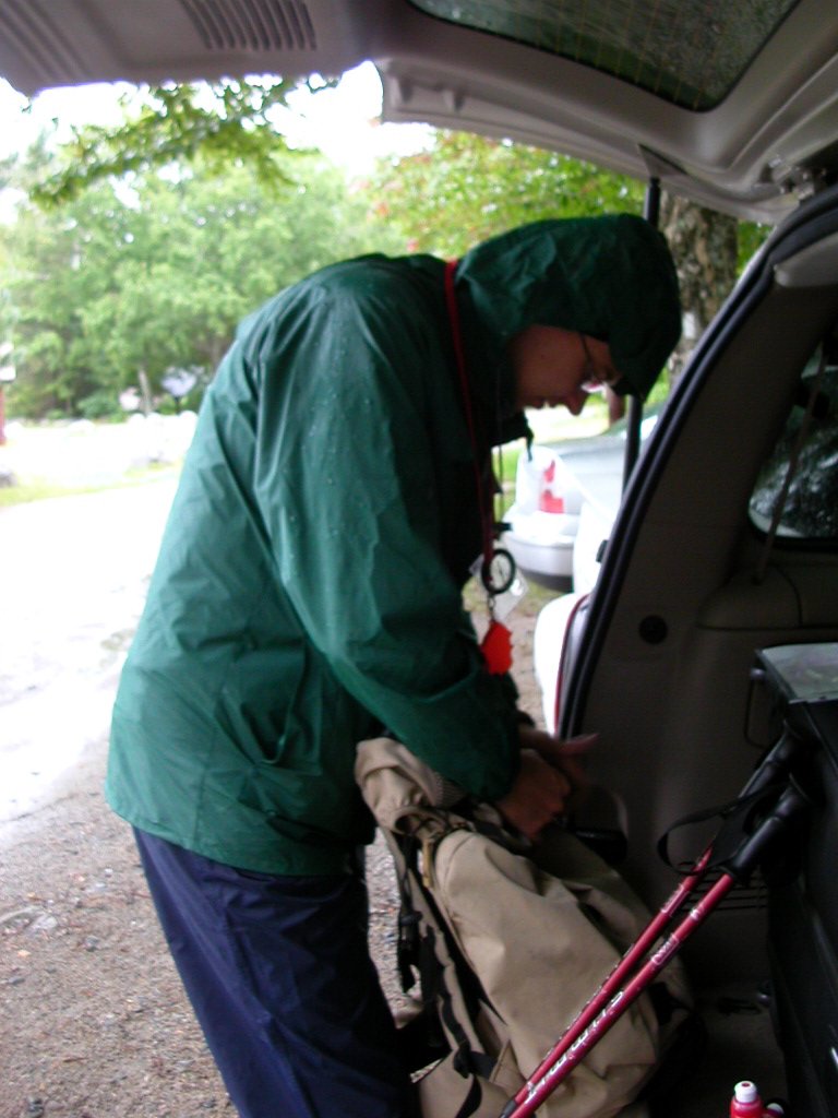
Day 1: Last Preparations |
|

|
|
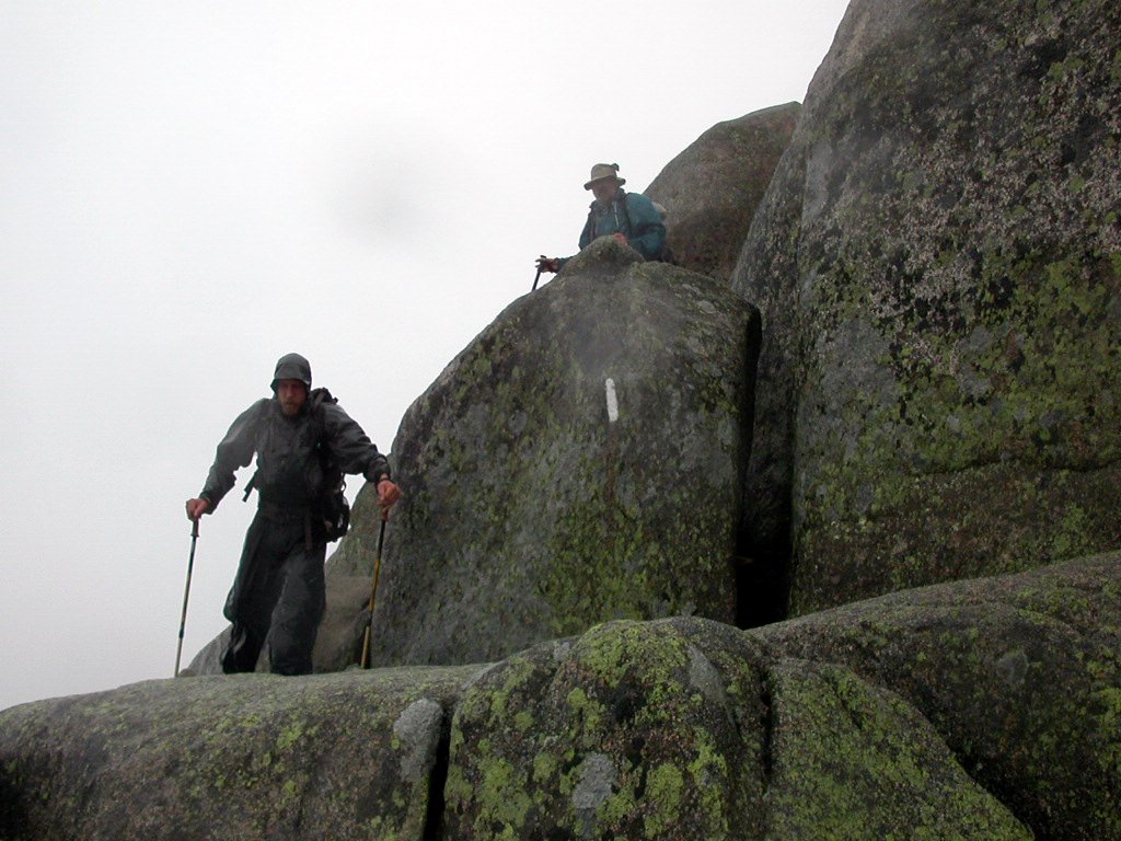
Start of the boulder field. Calling this a "trail" is quite a stretch :-) |
|

|
|
Other climbers descending the boulders. |
|

|
|
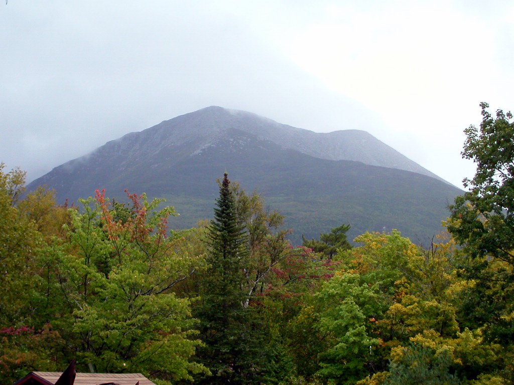
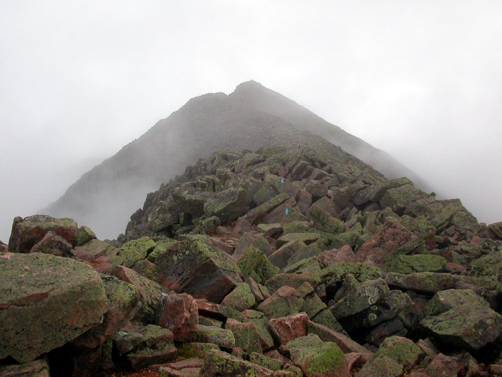
Day 2: I can see the mountain, this is hopeful! |
|

|
|
On the trail |
|
|
|

|
|
The Cave |
|

|
|
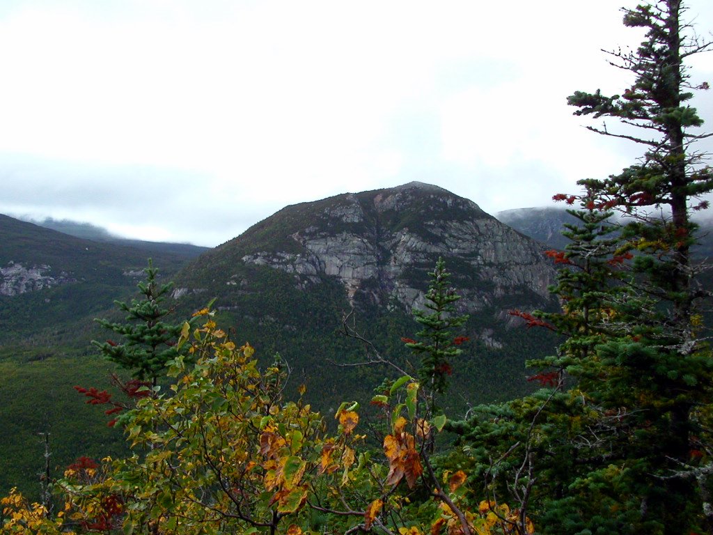
Views from the trail |
|

|
|
Boulder field again. My camera is pointing mostly upwards. |
|

|
|
Hunt Spur |
|

|
|
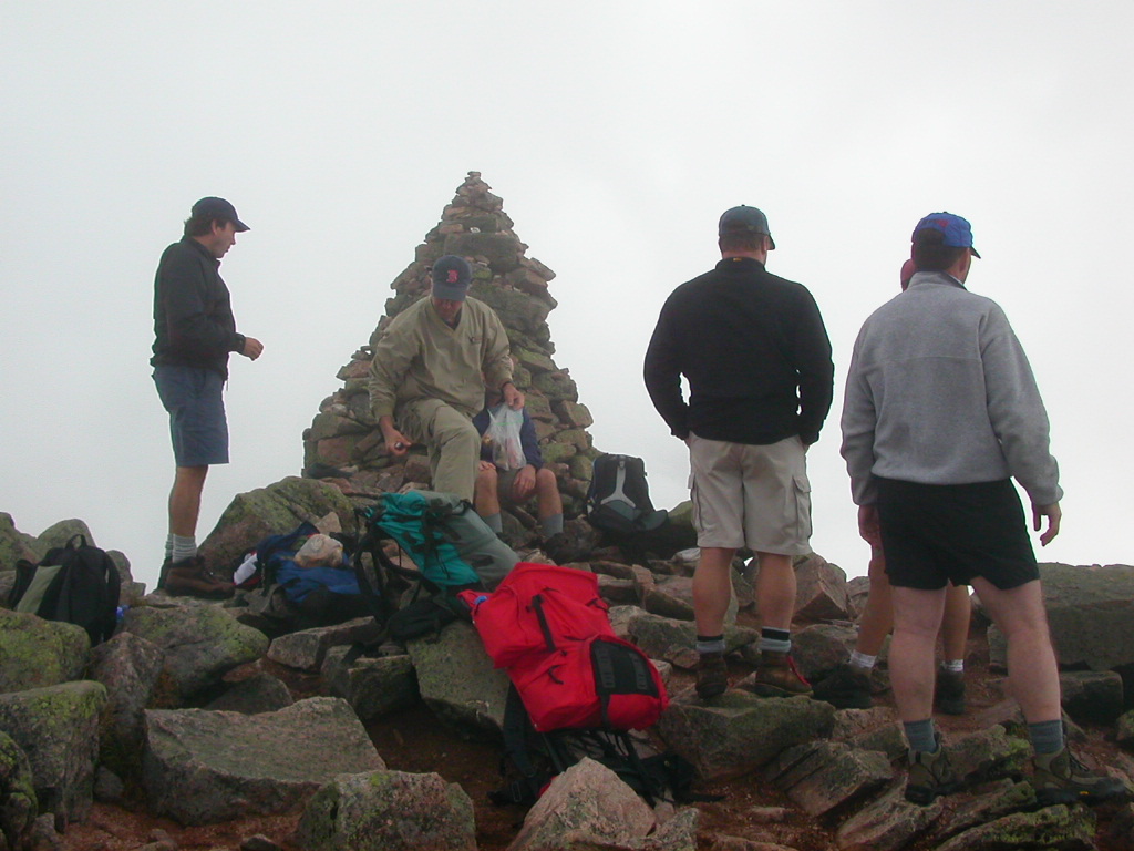
Other hikers on the summit |
|
|
|

|
|
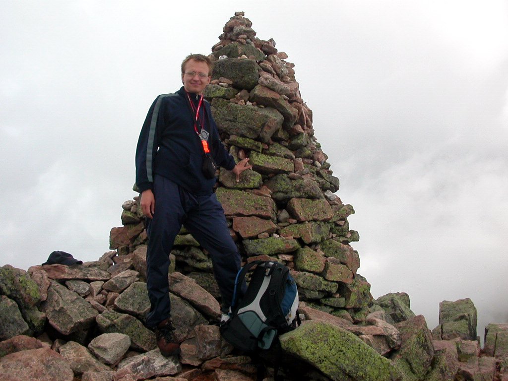
Summit! |
|

|
|
Knife's Edge trail. The other people were about to traverse this, definitely braver than me. |
|

|
|
Views from the top |
|

|
|
Summit! |
|
|
|
Tagasi / Back
 Trail
map (click to enlarge, warning: big file)
Trail
map (click to enlarge, warning: big file)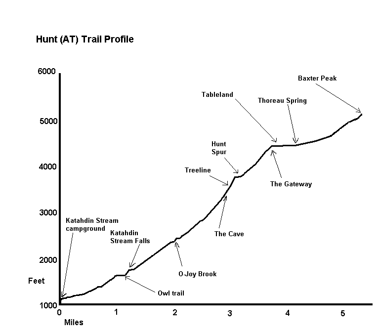 Trail profile (click to enlarge)