The Dusty Highpoint
[Summit team: Targo]
We arrived in the White Mountains area on June 21st 2005, right after
visiting Mt. Whitney and Death Valley, recording both extremes on my altimeter
in 24 hours. Most guidebooks mention Tonopah, NV as the nearest place for
lodging but there's actually a tiny motel in Montgomery Pass, much closer to the
mountain, and also much cheaper - we got a reasonable room for the whole family
for $30. The motel was a bit hard to find as most people appeared to have
abandoned the town. It was actually hidden behind a deserted casino, and there
was another, also deserted motel across the highway, further confusing matters,
so maybe this explains the low price.
Next morning we left for the trail. A dirt road starts from the junction of
state roads 264 and 773. There are a bunch of intersections but just following
the forks that seemed to take us closer to the mountain intuitively worked out
pretty well. The road does get a bit rough in the end though and I scratched the
bottom of my Camry a few times but it was passable. The trail itself was really
nice as long as it followed the stream but got pretty dusty after the springs
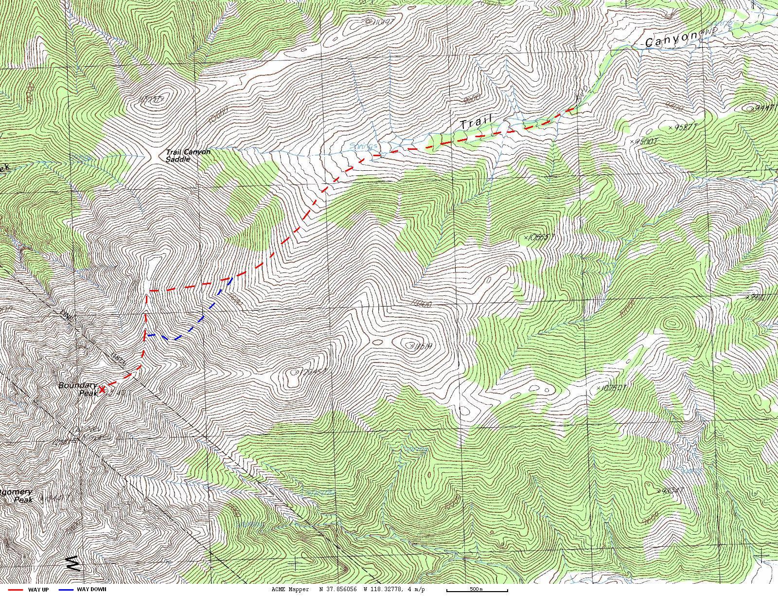
and finally got lost in a maze of cow trails. I started bearing left, aiming for
a little saddle about halfway between the peak and Trail Canyon Saddle. Once
above the vegetation line I found the trail again and trodded up the slope. The
grade wasn't too bad but it was 100% scree at that point, which slowed me down
considerably. It got better once on the ridge but now the main obstacle turned
out to be piles of huge boulders in a few places along the ridge. I didn't feel
too adventurous and simply skirted around them, which was further complicated by
deep half-melted snow, so I kept post holing every few steps and wishing I had
taken my snowshoes with me. The start of the final summit ridge was the worst, I
spent 15 minutes gaining less than hundred vertical feet at one point.
The summit itself was nice, someone had built a small wall to protect people
from wind behind which I could sit down and read the summit register. Apparently
there had been exactly one party on the summit every day for the last week or
so, and I was the only one there on that particular day. Going back was a lot
easier (see splits table below) as the scree works both ways, making descent a
lot faster than ascent. Also, I could use the last snow and covered significant
distance glissading. All in all, the descent took only 1 hour and 45 minutes
(compared to a 4 and a half hour ascent).
Map of the route (large file!):

My approximate splits for different parts of the hike:
| Leg |
|
Elevation Gain/Loss (ft) |
Time (hr:min) |
| Trailhead - Springs |
|
700 |
0:35 |
| Springs - Fork in canyon |
|
400 |
0:25 |
| Fork in canyon - Saddle |
|
2000 |
2:00 |
| Saddle - Summit |
|
1100 |
1:30 |
| Break |
|
0 |
0:20 |
| Summit - Start of the slope |
|
-900 |
0:45 |
|
Start of the slope - Fork in canyon |
|
-2200 |
0:30 |
| Fork in canyon - Trailhead |
|
-1100 |
0:30 |
| Total: |
|
4,200-4,200 |
6:35 |
Pictures of the climb:
|
|

|
|
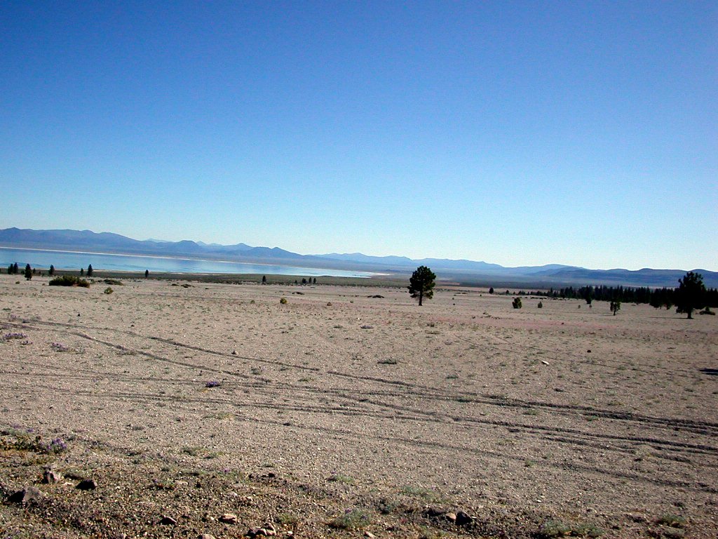
Nearby point of interest: Mono lake |
|

|
|
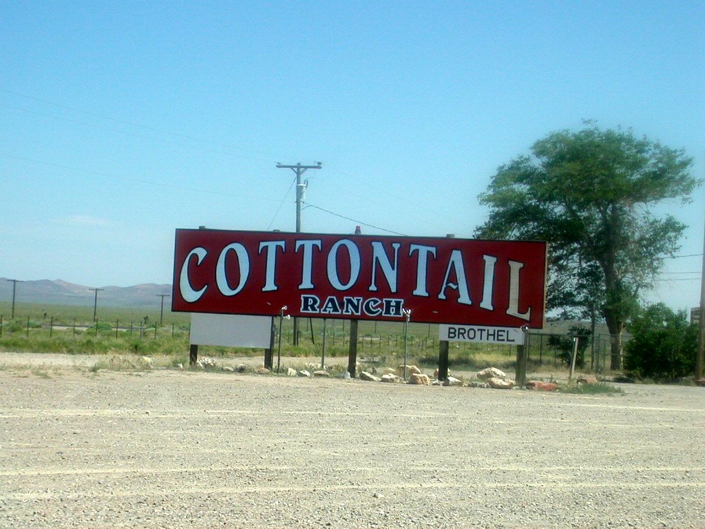
Nearby point of interest: life in Nevada |
|

|
|
White mountains |
|

|
|
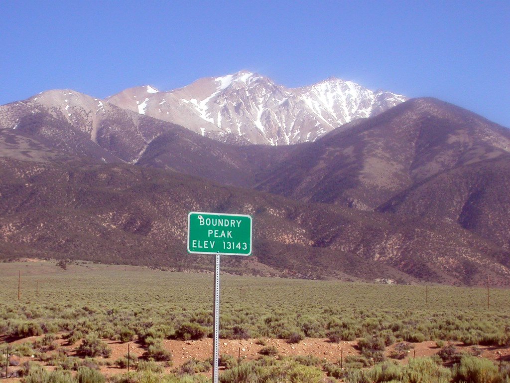
Boundary peak from highway 6 |
|

|
|
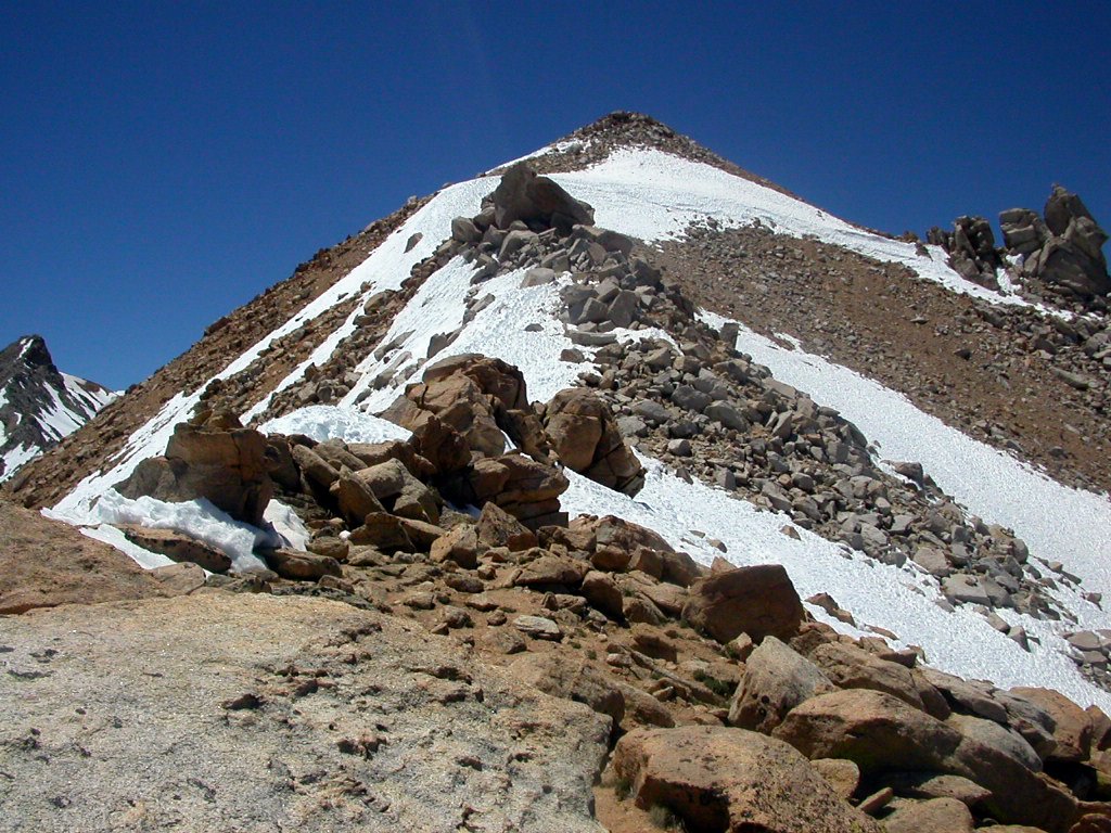
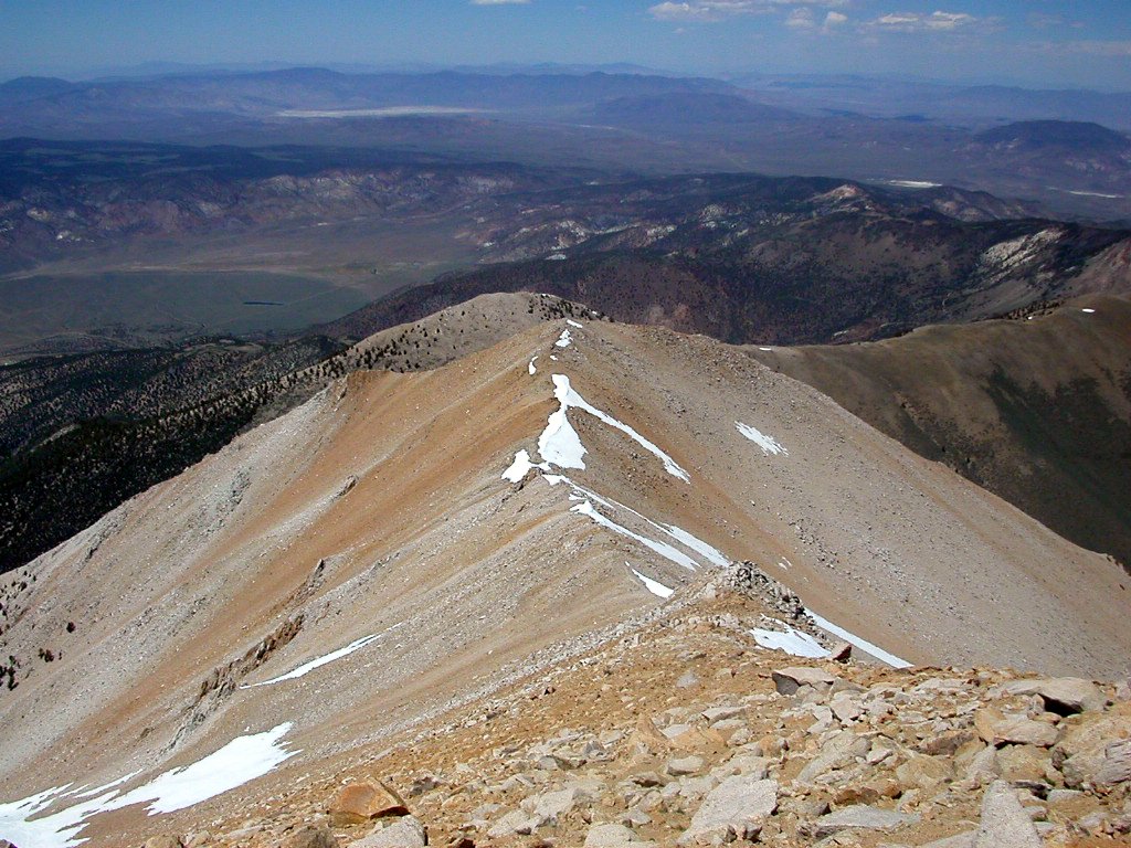
The ridge before Boundary peak. You can see the snowslope that I used to glissade down right under the peak |
|
|
|

|
|
Looking back to Trail Canyon |
|

|
|
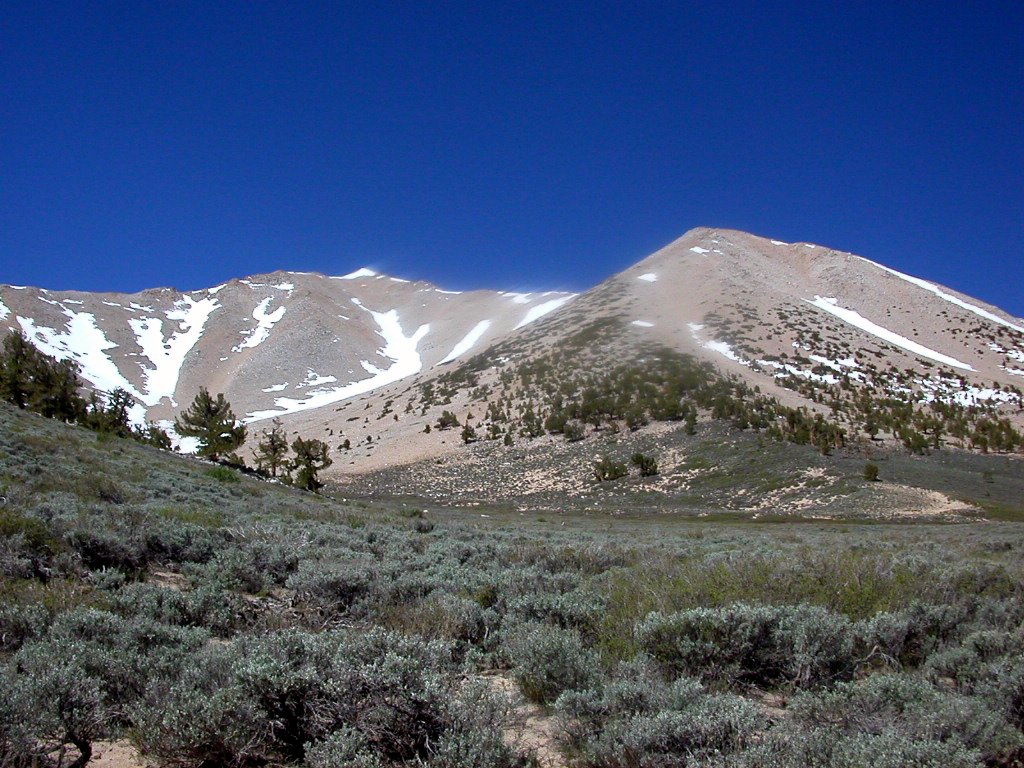
The summit ridge |
|

|
|
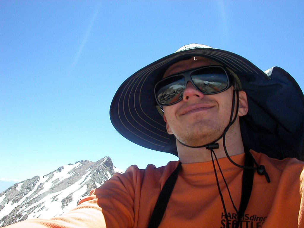
Me on the summit |
|

|
|
Montgomery peak behind me |
|

|
|
Another canyon south of Trail Canyon |
|
|
|

|
|
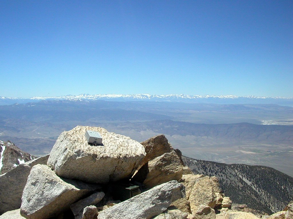
Sierra Nevada range |
|

|
|
Montgomery peak |
|

|
|
The ridge leading back to Trail Canyon |
|

|
|
The ridge leading back to Trail Canyon |
|
|
Tagasi / Back